Few places in Iceland let you stand on ground that did not exist five years ago. The Fagradalsfjall area on the Reykjanes Peninsula is one of them. Between 2021 and 2023, a sequence of eruptions remade a large section of the peninsula, burying valleys, redirecting topography, and producing lava fields that are still warm in places just below the surface. This is not a reconstructed or interpreted landscape. It is the real thing, and it requires a certain kind of attention to move through it well.
Why it’s worth the trip
Reykjanes had been volcanically quiet for roughly 800 years before March 2021, when a fissure opened near Fagradalsfjall mountain and began producing basaltic lava flows. Subsequent eruptions followed in 2022 and 2023, each one adding new material and altering the terrain that previous visitors had already walked. The result is a layered geological record compressed into a very small area, where you can observe the textures of different flow events side by side.
The lava here is primarily pahoehoe and aa basalt, the two main flow types, and the difference between them is immediately visible underfoot. Pahoehoe has a smooth, ropy surface that folds over itself as it cools. Aa is the rough, clinker-like rubble that breaks underfoot and makes footing unpredictable. Cinder cones rise from the field, their steep flanks loose with scoria that shifts if you apply weight to it carelessly. Solidified lava channels, the tubes through which flowing rock once moved, cut across the landscape like shallow trenches with glassy interiors.
None of this requires a geology background to appreciate, but knowing what you are looking at changes the experience considerably. The visual variety in the field is significant enough that even a slow three-hour walk involves constant observation.
How to get there
The access point most commonly used is the trailhead at Suðurstrandarvegur, reached by driving south from Reykjavik on Route 41 and then turning onto roads that lead toward the Fagradalsfjall area. The drive from Reykjavik takes roughly 40 to 50 minutes depending on which trailhead you are targeting. The Reykjanes Peninsula is small and well-connected by road, so navigation is not complicated.
Parking at the main trailheads filled quickly during periods of active eruption and can still be busy in summer. Arriving early in the morning or later in the afternoon reduces competition for space. Public transport connections to the area are limited, and most visitors arrive by car or on organized day tours from Reykjavik. If you are traveling without a car, checking whether tour operators still run scheduled departures to this site is worth doing before you plan around it.
The walk from the main trailhead to the edge of the most recent eruption zones is a moderate hike of several kilometers each way over uneven terrain. Trekking poles help significantly on the rougher lava surfaces.
What to expect on arrival
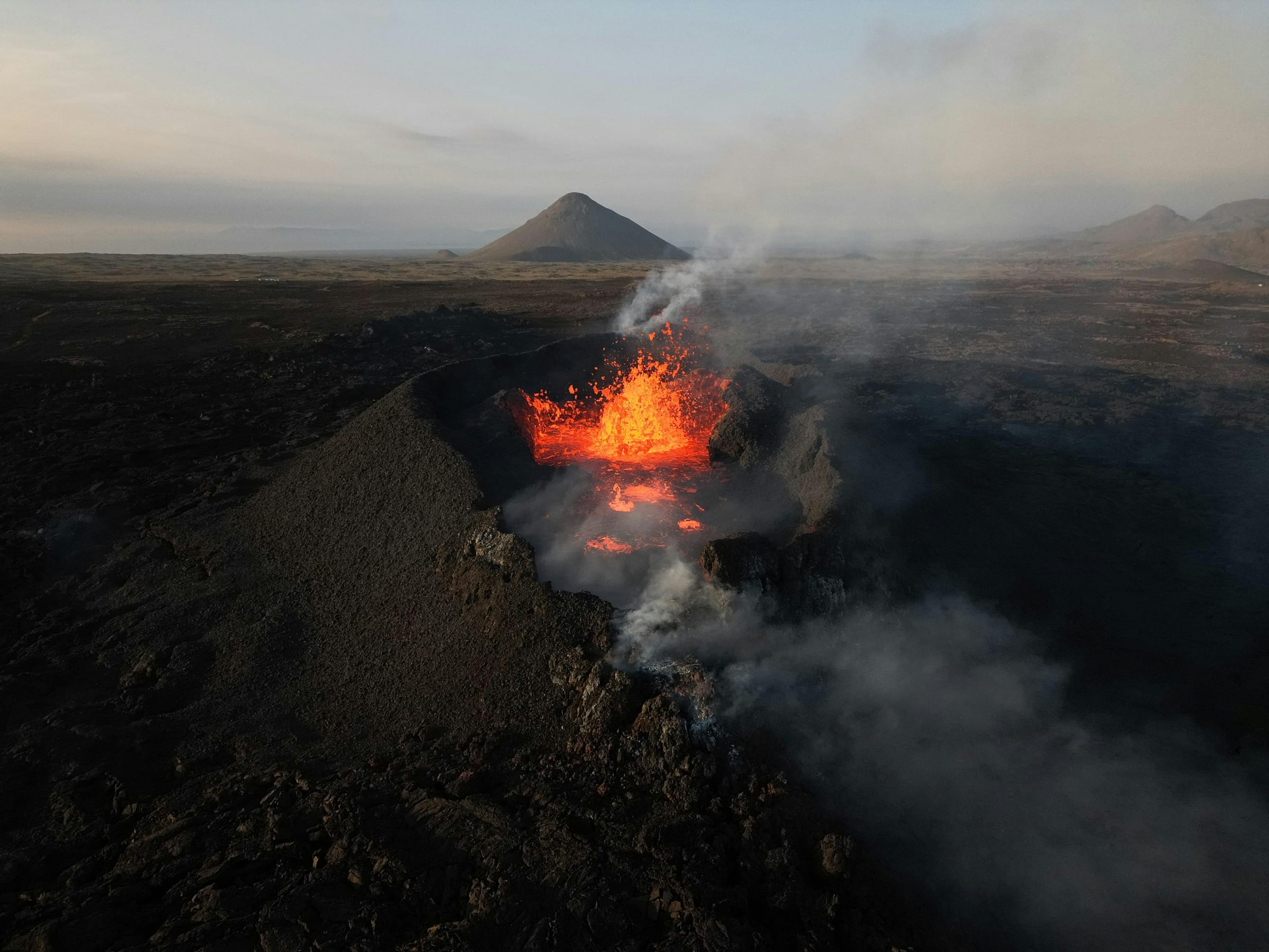
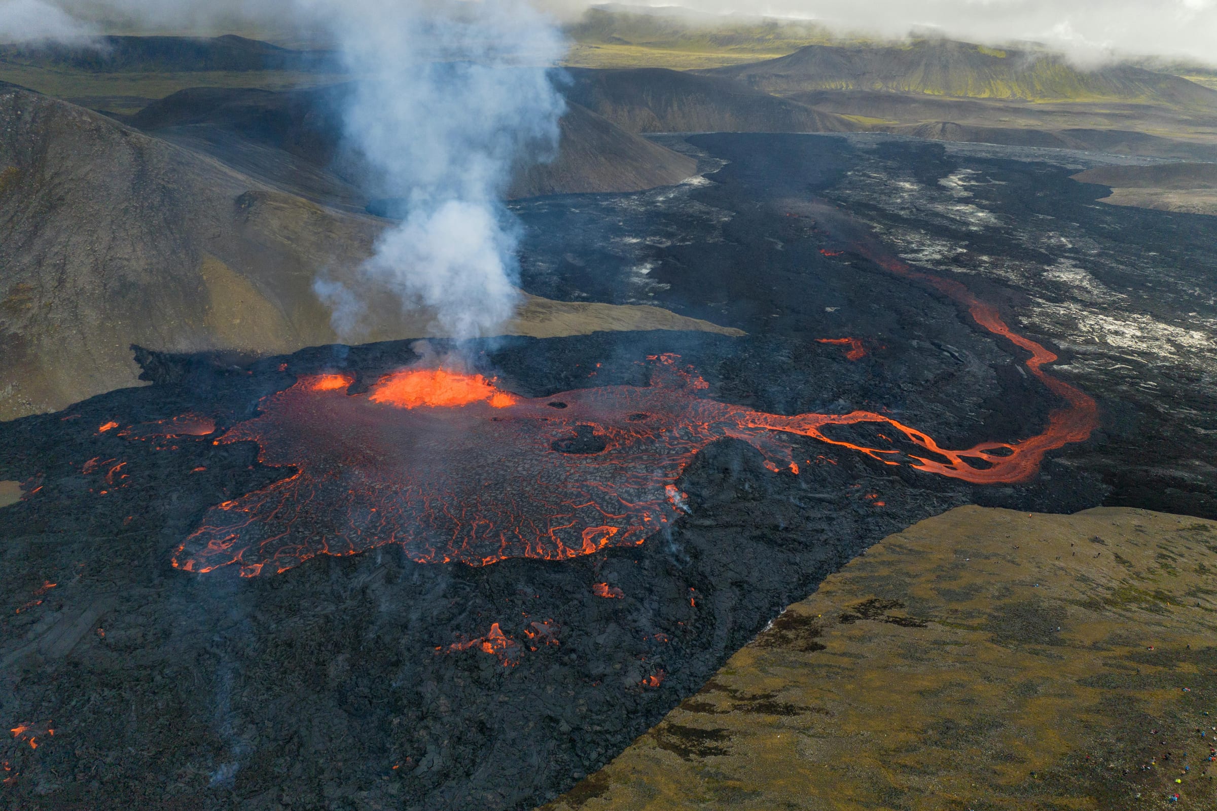
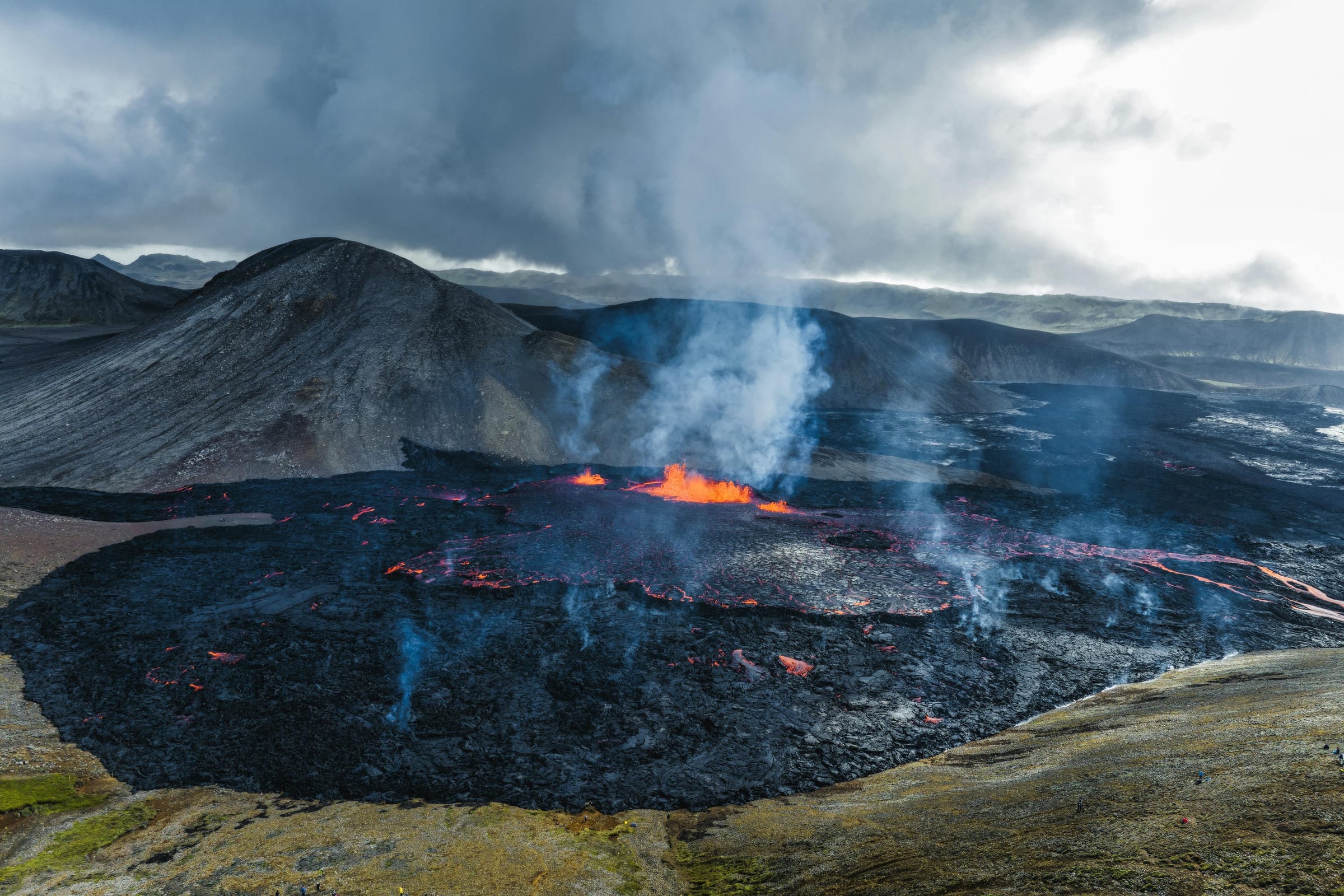
The first thing you notice is the scale. Photographs of lava fields tend to flatten the experience. In person, the flows have genuine height variation, pressure ridges running across the surface, and depressions that drop away without warning. The trail markings are placed carefully and should be followed. Leaving marked paths on fresh lava fields carries real risk: surfaces can be unstable, and crusted-over lava can conceal voids where the interior drained out during flow.
The color of the landscape shifts as you move through it. Older flows have begun developing a thin oxidized crust in shades of orange, red, and rust. Fresher material stays black and grey. At certain points you can look across a valley that was green and grassy in 2020 and see nothing but basalt. The transition at the edges of the flow, where lava stopped and vegetation survived, is abrupt and worth pausing at.
Wind on Reykjanes is constant and often strong. The exposed lava field provides no shelter. Temperatures can feel significantly colder than what you left in Reykjavik, particularly if cloud cover and wind arrive together. Bringing an extra layer regardless of the forecast is practical, not overcautious.
Sulfurous gases were present during active eruption phases. Conditions change, and the area should be treated as a dynamic environment. Before visiting, checking the status updates from the Icelandic Meteorological Office and the Department of Civil Protection is sensible. These agencies issue advisories when gas conditions or terrain changes make access inadvisable.
When to go
Spring, summer, and early autumn give the best conditions. Snow and ice complicate the lava field considerably, turning already uneven ground into something genuinely hazardous. The long daylight hours of summer allow for flexible timing, and evening light on the basalt surface produces a quality of observation that midday does not. That said, overcast days diffuse light in ways that actually bring out the texture of the lava more clearly than harsh sun.
The site receives heavy visitor traffic in summer. Arriving outside peak midday hours reduces crowding, though the Reykjanes Peninsula rarely feels as saturated as some areas closer to the Golden Circle. Autumn brings fewer people and stable enough weather through October in most years, though conditions become less predictable as the season progresses.
Spring visits, particularly in April and May, offer reasonable weather with thinner crowds, though some years see late snow on the higher ground approaching the fissure zone.
Tips and responsible-visitor notes
A few practical points worth keeping in mind before you go:
- Footwear matters more here than on most Icelandic hikes. Hard-soled boots protect your feet from the sharp edges of aa lava and provide ankle support on unstable scoria slopes. Soft-soled shoes are genuinely uncomfortable over distance on this terrain.
- Carry more water than you think you need. There is no source of water in the lava field, and the physical effort of moving over uneven ground adds up.
- Stay on marked trails. This applies everywhere in Iceland but has particular force on active or recently active volcanic terrain where the ground surface can be deceptive.
- The gas situation changes. Even in quiet periods, pockets of volcanic gas can accumulate in depressions. If you smell sulfur strongly and feel any irritation, move upwind and to higher ground.
- Dogs are not permitted in some parts of the area, and rules may have changed since previous visits. Confirming current regulations before bringing animals is worth doing.
The Fagradalsfjall landscape is not comfortable in the way that a forest walk is comfortable. It asks something of you physically and asks you to pay attention. That is, ultimately, what makes it worth the effort.