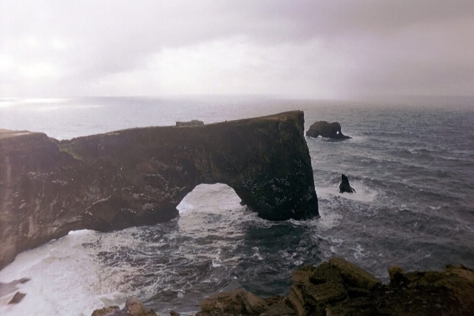
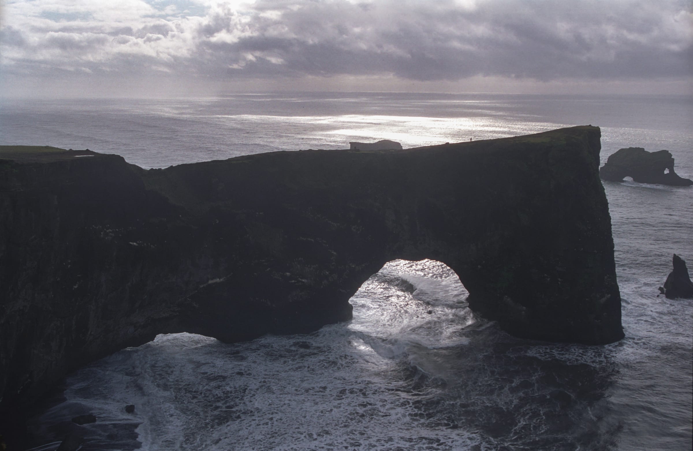
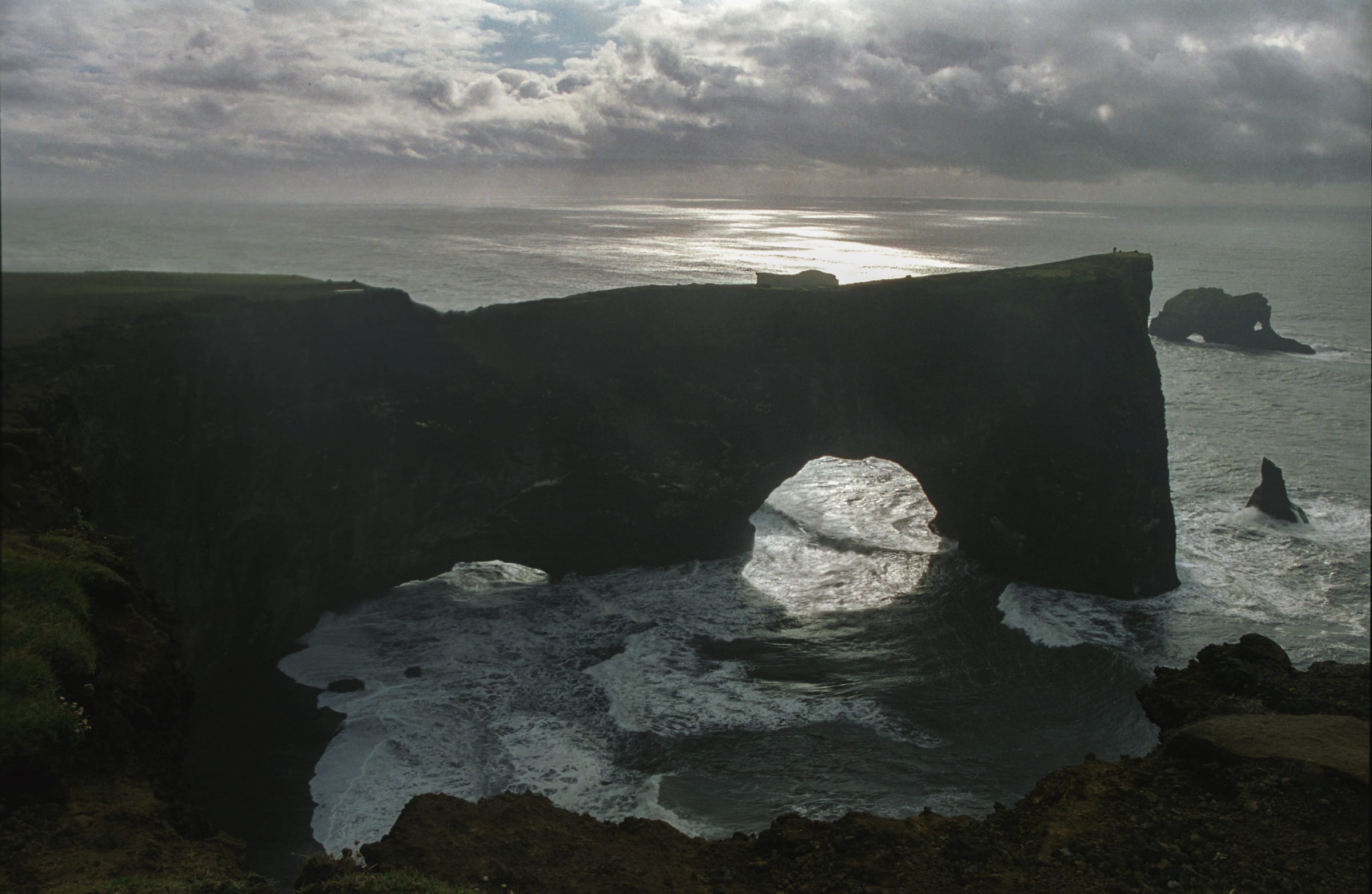
Dyrhólaey sits at the southernmost point of Iceland’s mainland, a blunt wedge of volcanic rock pushing out into the North Atlantic where the land simply runs out. The arch at its base is genuine in scale: boats have passed beneath it, and the opening frames the sea in a way that makes distances difficult to read. At roughly 120 metres above the water, the upper viewpoint gives a sweep across Reynisfjara and the black sand coast that stretches east toward Vík. This is a working landscape still shaped by wind, surf, and nesting birds, and it rewards visitors who slow down rather than rush the standard loop.
Why it’s worth the trip
The primary draw is the combination of geological drama and wildlife in one compact location. The promontory itself is a remnant of volcanic activity, dark and dense, contrasting sharply with the pale surf breaking beneath it. The arch, Dyrhólaey in Icelandic meaning roughly “door-hole island,” is visible from the lower parking area and from the beach to the west. It is not a delicate structure. It has a solidity that makes it feel permanent, though the sea works on it steadily.
The Atlantic puffin colony arrives each spring and uses the grassy cliff edges and slopes for nesting. During peak season the birds are close enough to observe without optical equipment, though binoculars sharpen the detail considerably. Puffins are small, unhurried, and largely indifferent to careful observers who keep their distance. Watching them carry sand eels back to burrows is a slow, repetitive pleasure. There are also fulmars, guillemots, and other seabirds present through the warmer months.
Beyond the wildlife, the views are genuinely useful for understanding South Coast geography. From the upper platform you can see how the black sand beaches extend in a long arc, backed by the cliffs at Reynisfjara to one side and the low coastal plain stretching toward Skógafoss on the other. On a clear day the glacial tongue of Sólheimajökull is visible to the north. Visibility here is highly variable, and cloud can sit directly on the headland even when the coast below is clear. That is not a reason to skip the upper viewpoint, but it is worth factoring into expectations.
How to get there
Dyrhólaey lies a short distance off the Ring Road (Route 1), west of Vík. The turn is signposted and leads to a road that splits, giving access to both the lower lighthouse road and a path toward the beach and arch base. The upper road to the lighthouse and main viewpoint is narrow and climbs steeply; it is paved but requires reasonable care in wet conditions. Standard two-wheel-drive vehicles manage it without difficulty in normal summer weather, though the surface can be slick after rain.
The site sits approximately two hours by road from Reykjavík in good conditions. Vík itself is nearby and provides fuel, accommodation, and food, making it a practical base if you plan to spend time on this section of the coast. Dyrhólaey pairs naturally with Reynisfjara beach, which is a short drive east, though the two are distinct sites with different characters and should not be compressed into a hurried visit.
What to expect on arrival
There are two distinct areas to explore. The lower area gives access to a beach with views back toward the arch from ground level. Standing on the sand and looking up at the rock formation provides a completely different sense of its scale compared to the clifftop perspective. The arch opening is large and roughly framed; the dark basalt is streaked and marked by weather. This lower visit is a short walk and takes perhaps twenty to thirty minutes depending on how long you linger.
The upper viewpoint, reached via the lighthouse road, is where most visitors spend the bulk of their time. The lighthouse itself is a functional structure, not open to the public in the usual sense, but the ground around it and the cliff edges provide the main viewing positions for both the arch and the coastal panorama. There are informal paths along the cliff edge. These are not always fenced or formally marked, and the drops are serious. Wind at this elevation can be strong and unpredictable. The combination of loose grass, steep slopes, and variable gusts means the edge deserves attention, particularly with children or in wet conditions.
The puffin nesting area requires visitors to stay on established paths. The birds nest in burrows directly in the soil on the slopes, and it is straightforward to disturb them or damage nest sites by walking off track. This is not a rule imposed purely for aesthetics; active disturbance affects breeding success. The viewing is good from the paths. There is no need to approach further.
When to go
Spring through summer, roughly late April through mid-August, covers the puffin season and represents the most rewarding window for a visit. Puffins generally arrive in April and depart by late July or August. Outside this period the headland is still accessible and the views remain, but the specific wildlife draw is absent.
The summer months also bring longer daylight, which has practical value here: the lower light in the evening hours is useful for photography without being the primary reason to time a visit. Midday in summer produces flat light on a south-facing promontory, which flattens the texture of the rock surfaces considerably. Morning or late afternoon visits are generally more visually productive.
Weather on the South Coast is changeable throughout the year. Rain, low cloud, and wind are common even in summer, and a trip in fog yields almost nothing from the upper viewpoint. Checking the Icelandic Met Office forecast before driving out is straightforward and worth the two minutes.
Tips and responsible-visitor notes
- The closure of the upper road during nesting season varies by year; local notices and the Icelandic Environment Agency website carry current information.
- Drone use is restricted in the area to protect nesting birds. Follow posted rules and err on the side of caution.
- The beach at the lower area involves a surf-exposed shoreline. Sneaker waves are a documented hazard on South Coast beaches in Iceland. Do not turn your back on the water.
- Bring layers regardless of the forecast. The temperature on the promontory consistently runs colder than the car park suggests.
- The site receives significant visitor numbers through summer. Early morning arrivals find quieter conditions on both levels.
.jpg)
.jpg)
.jpg)