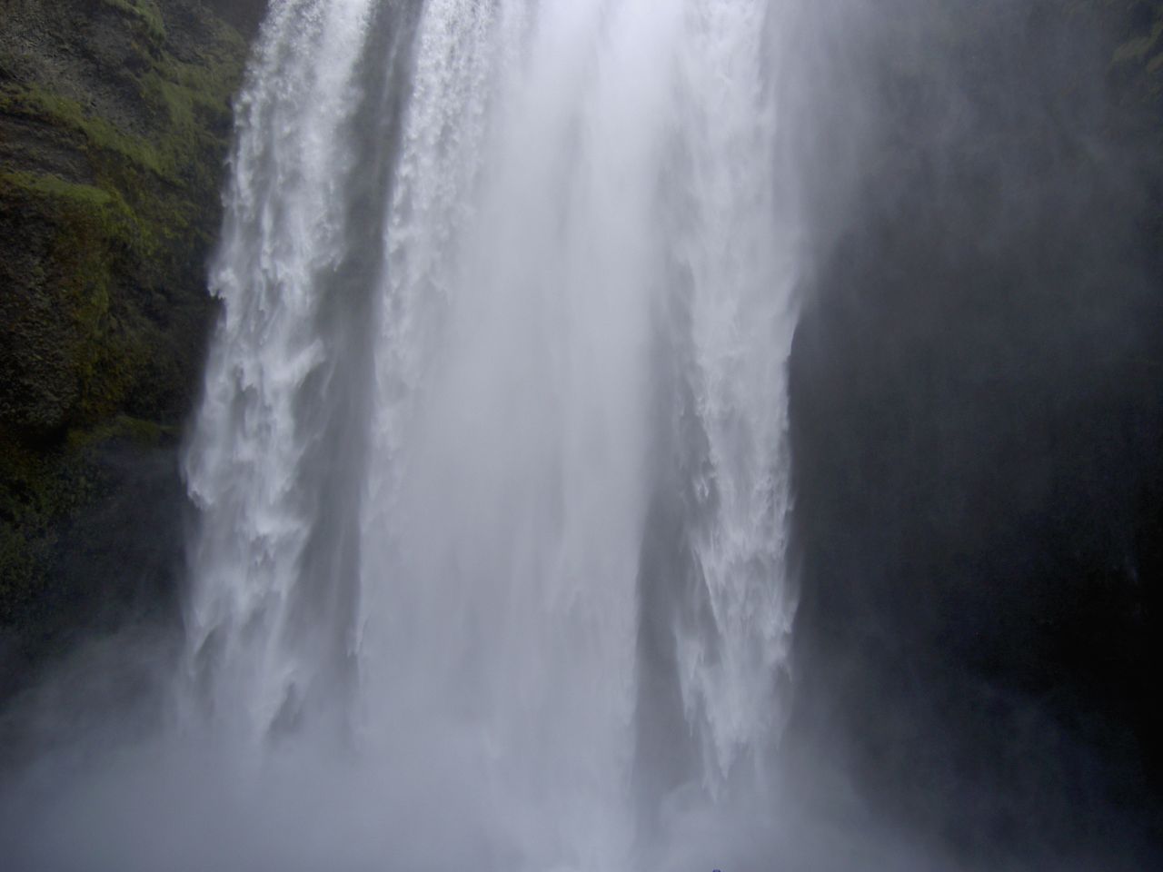
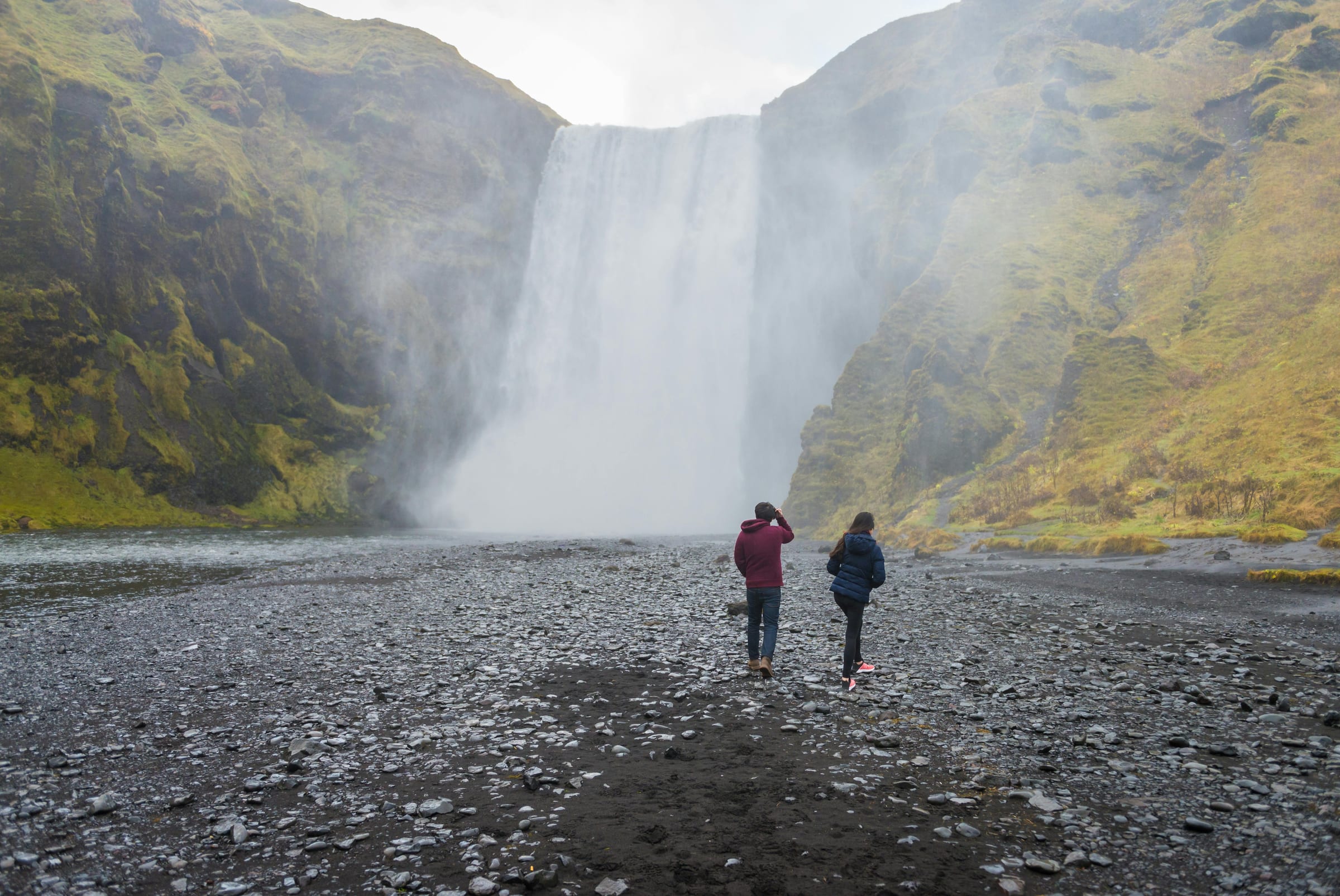
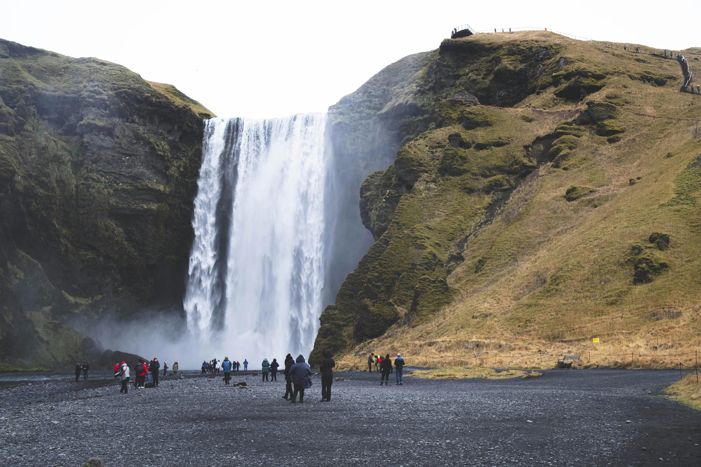
The Fimmvörðuháls trail does not ease you in gently. It starts at the base of Skógafoss, a wide curtain of water that soaks the air for a hundred metres around it, and then climbs without apology for several kilometres before you reach anything resembling flat ground. That opening is a fair statement of what the whole route is about: sustained effort, dramatic reward, and almost no moment where the landscape lets you switch off.
Why it’s worth the trip
The 25 kilometre crossing between Skógafoss and Þórsmörk is among the most geologically varied day hikes in Iceland, which is saying something in a country built from eruptions and ice. The lower third of the route follows the Skóga river upstream through a gorge lined with roughly 26 waterfalls, each distinct enough that you find yourself stopping at nearly all of them rather than pushing through. Some fall in single vertical drops. Others fan out across dark basalt shelves. The sound is continuous.
Above the gorge, the trail moves onto the high plateau between two glaciers: Eyjafjallajökull on the west and Mýrdalsjökull on the east. In clear conditions the ice tongues are close enough to read their surface texture, the crevasses and compression ridges that form as glaciers move over uneven ground beneath. The scale of the pass itself, somewhere around 1000 metres elevation, makes the waterfalls below feel like another country.
Then there is the lava field. In the spring of 2010, the Eyjafjallajökull eruption created two new craters at Fimmvörðuháls, and the lava that poured from them is still sharp-edged and raw in appearance. It has not had centuries to weather into something softer. Walking across it feels geologically recent because it is. The craters, named Magni and Móði, sit near the trail’s highest point and are among the few places in Iceland where you can stand next to actively forming land without any particular specialist knowledge or equipment. The descent into Þórsmörk drops through birch scrub and onto river flats backed by the kind of steep, eroded ridgelines that make the valley immediately recognisable in photographs.
The full route takes most fit hikers around 10 hours. Some people manage it in less. A few take longer. It is a hard trail by any honest measure: the elevation gain from sea level to the plateau is significant, the terrain on the lava field is uneven and requires attention, and the descent into Þórsmörk adds kilometres when your legs are already tired. Do not underestimate any of those three factors.
How to get there
Skógafoss sits directly on the Ring Road (Route 1) on the South Coast, roughly 150 kilometres east of Reykjavík. Most people travelling from the capital pass through the nearby town of Hvolsvöllur and continue east along the coast. The waterfall is visible from the road.
The logistical challenge of this trail is that it is a linear route. You start at one place and finish at another. That requires either arranging transport at both ends or making peace with the fact that you will need to get yourself back from Þórsmörk, which sits at the end of a rough highland road accessible only by four-wheel-drive vehicles or the seasonal buses that serve the interior. Most hikers either pre-book a seat on a return bus from Þórsmörk or arrange a car shuttle with another group doing the trail in the opposite direction. Starting at the Skógafoss end is the more common approach because it gets the steepest climbing done while legs are fresh.
What to expect on arrival
The trailhead is at the base of the falls, where a well-worn path cuts to the right and begins ascending the cliff beside the waterfall. The route is marked, and in summer the lower sections see enough traffic that the path is obvious. As you climb higher and cross onto the plateau, visibility and route-finding become more dependent on weather. Fog and cloud at elevation can reduce visibility to a few metres, and the plateau’s open terrain offers no shelter. In poor conditions, even experienced hikers have turned back from this section.
The waterfalls along the river gorge are genuinely worth slow attention rather than being treated as a warm-up for the high ground. Many visitors to Iceland see Skógafoss itself from the car park and walk no further. The series of falls above it is comparatively quieter and rewards the initial effort of the climb quickly.
On the plateau, wind is the dominant physical factor. Even on a warm summer day at sea level, the pass between the glaciers can be cold and exposed. Layering matters here. The lava field requires care underfoot. The rock is angular and unstable in places, and moving across it quickly is not advisable.
The descent into Þórsmörk is long. Budget time and knee energy accordingly. The valley itself has huts and basic facilities run by the Ferðafélag Íslands (Iceland Touring Association) and the organisation Útivisst, but specific current details on booking and services should be confirmed directly with those organisations before travel.
When to go
The trail is realistically passable during the summer months, broadly June-September, with July and August being the most reliable window. Snow lingers on the plateau well into June some years, and the first significant autumn snows can arrive in September. Conditions vary year to year, and it is worth checking with local guiding services or mountain hut wardens before committing to a crossing date.
The trail is not suitable in winter or early spring without mountaineering experience and the appropriate equipment. The glacial environment at the high point carries objective hazards that do not disappear simply because the sun is shining.
Tips and responsible-visitor notes
- Start early. A 10-hour day with a meaningful transit problem at the end has no margin for a late departure.
- Carry more water than you think you need; the gorge section has sources but the plateau does not always offer safe, accessible ones.
- Register your route with safetravel.is before setting out. This is standard practice for highland routes in Iceland.
- Weather forecasts from vedur.is cover the highland zones specifically and are more useful for this trail than general forecasts.
- Stay on marked paths across the lava field. The new rock is fragile and the area around the 2010 craters is sensitive.
- Þórsmörk huts fill up in peak season. If you plan to stay rather than arrange same-day transport out, book well in advance.
.jpg)